


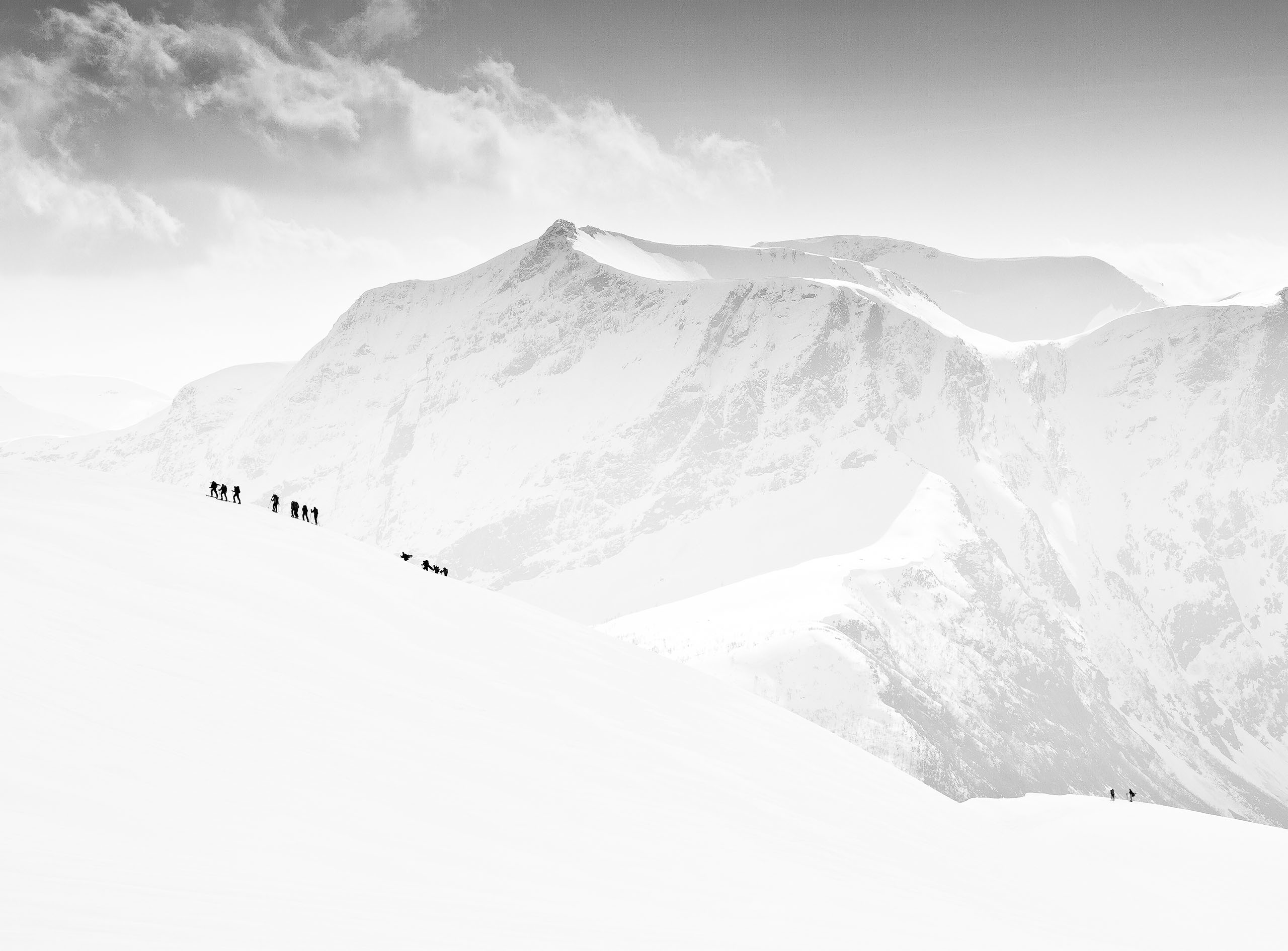
|
|
|
|
by Hua Zhu
Published the 28th of August 2020
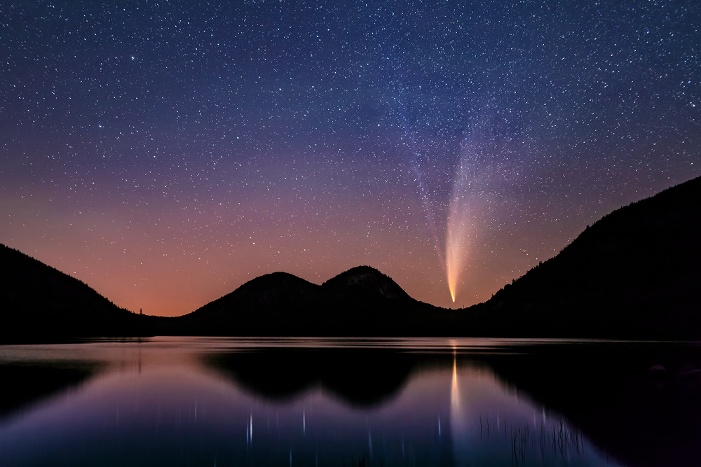
'Comet NEOWISE' by Hua Zhu
Recently, those in the Northern Hemisphere observed the stunningly bright two-tailed comet NEOWISE streak across the night sky. NEOWISE will not return for more than 6,000 years according to NASA.
Because of this, numerous photographers, including myself, planned to photograph this rare “icy snowball” as it passed by.
The question then became exactly when and where would yield the best shot?
What would its direction and height be at a particular time?
What would be the relative position between the comet and the shooting subject?
Will the surroundings be dark enough to photograph the comet?
While I took all these questions into account, I noticed that the smartphone app, Planit Pro, had just added a new comet feature which answered all my questions and more, as well as allowed me to easily and accurately predict the comet’s position at a specified time and place.
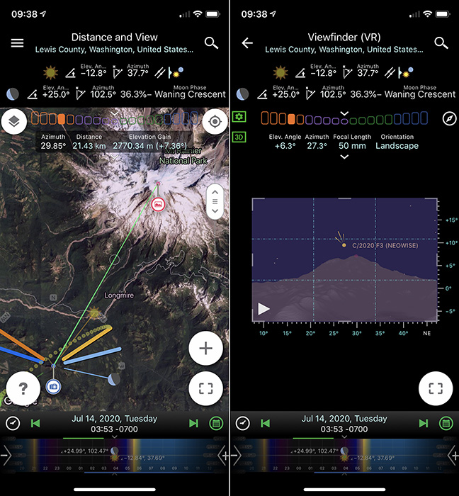
Mt. Rainier Map
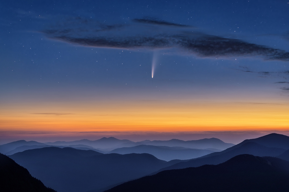
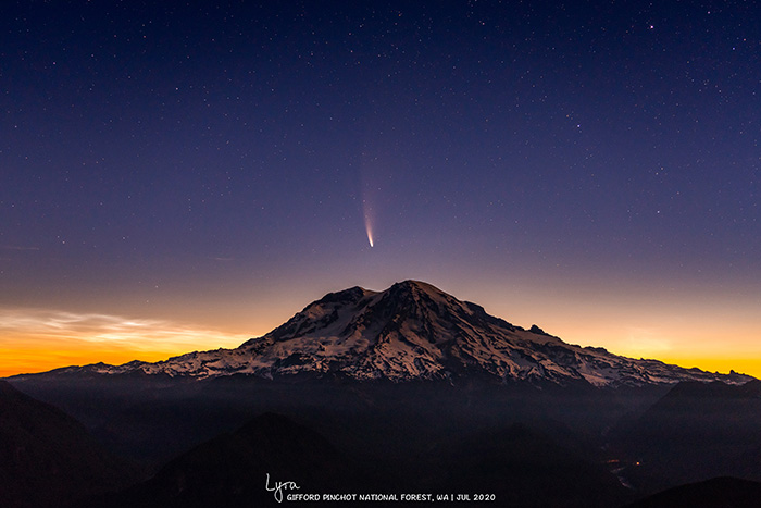
Lyra and Eric, a young couple living in Oregon, USA, also used this app to plan their trip right from home. They wanted to photograph NEOWISE just above Mount Rainier, a picturesque landmark in Washington State, USA. With the app, they were able to find the perfect time and location to capture the comet as it travelled over Mount Rainier. Their ideal spot was High Rock, a lookout trail located approximately 1,700 meters above sea level and 22 kilometres from the peak of Mount Rainier. They reached High Rock at around 2:00 a.m. on July 14 and watched as NEOWISE moved to the perfect position as predicted by the app. That morning, Lyra and Eric captured a breathtaking photo of the comet hanging in the sky above a snowy mountain, with the waning crescent moonlight in the foreground and morning twilight in background, thanks to Planit Pro.
This is a typical example of the planning and effort put into landscape photography. Aside from the feature mentioned earlier, Planit Pro can also help you prepare in many other ways. It is crucial to meticulously plan your photo shoot, as it both improves your shot and makes the photography process more efficient. Currently, there are many other apps on the market that can assist you with planning a photo. However, Planit Pro is the most powerful of them all. As shown in the picture below, it contains all the ephemeris features a photographer could ever want, and more importantly, can be used to plan everything right at home – when to go, where to set up the camera, the suitable lens to carry and use, and when to shoot the picture. The app can also tell you what the light conditions will be like at any given time and location, and even display a simulated image of what you would capture. Although the multitude of functions and features in the app can be overwhelming at times, Planit Pro is a must-have for the perfect landscape photograph.
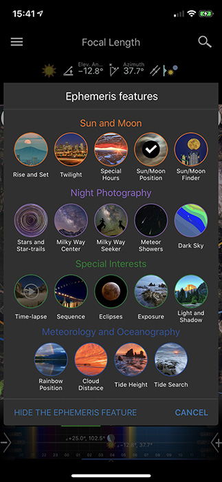
Ephemeris features
Information, instructions and tutorials on Planit can be easily found online, such as the Planit! for Photographers website and on YouTube. Given below are just some features in Planit that can instantly improve your landscape photos, especially night photography.
Sun/Moon Finder
This function allows you to adjust the position of the sun or moon for your desired composition and calculates the exact dates and times that this will occur. For example, I wanted to take a photo of the large moonset just as it passed the Statue of Liberty's torch. Planit helped plan everything I needed for a successful photo, including the exact dates and times to capture what I had in mind.
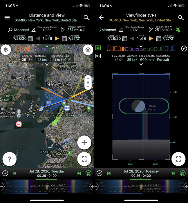
Statue of Liberty Map
As planned, this photo was taken at 12:26 a.m. from Brooklyn Bridge Park, New York City, 4.2 km (2.6 mi) away from the Statue of Liberty.
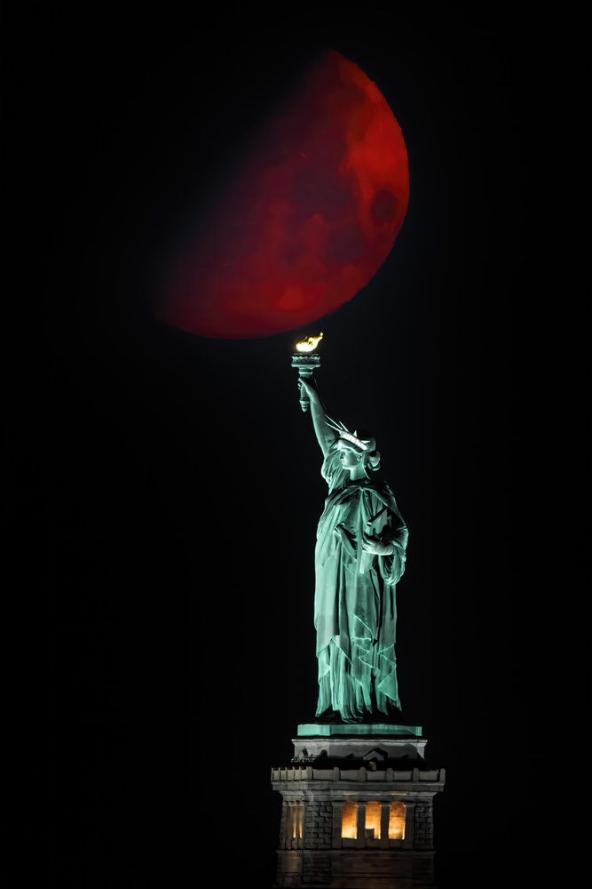
'Statue of Liberty and Moonset' by Hua Zhu
Stars and Star-trails
Planit contains information for all the major stars, planets, constellations, nebulae, comets and asteroids. In July, my friend and I also planned a photo trip to shoot comet NEOWISE together. However, due to the COVID-19 pandemic, we determined it would be safest to pick a shooting location within driving distance. Using Planit, we looked at several locations that satisfied our needs and finally decided on Jordan Pond in Acadia National Park, USA. We planned for NEOWISE to be reflected in the pond. The Planit app showed that the comet would be located on the left side of the North Bubble on July 16 before midnight, and then be blocked from view between 12:00-1:30 a.m. before reappearing from the South Bubble for a brief period of time. It was critical that we did not miss the opportunity to capture NEOWISE, but thanks to the precise calculations of Planit, we managed to perfectly photograph the comet in the short window of time before it disappeared again.
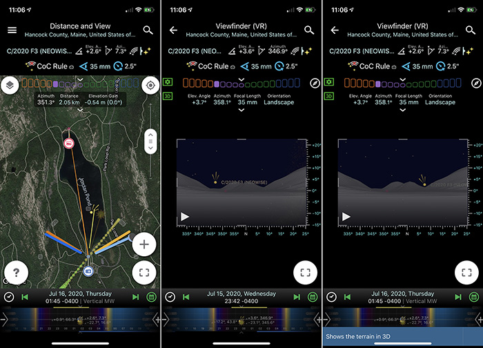
Jordan Pond Map
'Comet NEOWISE over Jordan Pond' by Hua Zhu
Milky Way Center
Planit is also extremely useful when planning photos of the Milky Way. The Milky Way Center function can help us find the Milky Way Galactic center at a specified time and location. For example, in the photo shown below, I wanted to take a full 180° panoramic photo of the Milky Way in the Valley of Dreams, New Mexico, USA. Planit showed that the best time to shoot would be just after midnight in late May, as the Milky Way would be rising from the East without any interference from the moonlight, making for the ideal shot.
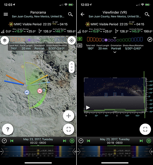
VOD MW Map
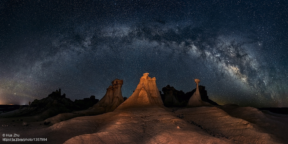 'Three wise men' by Hua Zhu
Milky Way Seeker
If you have a Milky Way composition in mind and want to find out when to take the shot, you can use the Milky Way Seeker tool in Planit. Michael Zheng, a photographer who captured the “Shuttle to Galaxy” photo shown below, used Planit to determine the best time to take this shot. He envisioned shooting the tall and thin rock together with the magnificent Milky Way center in Utah, USA. Planit helped him achieve not only the composition he wanted, but also the weak moonlight from the opposite direction to illuminate the surrounding environment.

Shuttle MW Seeker Map
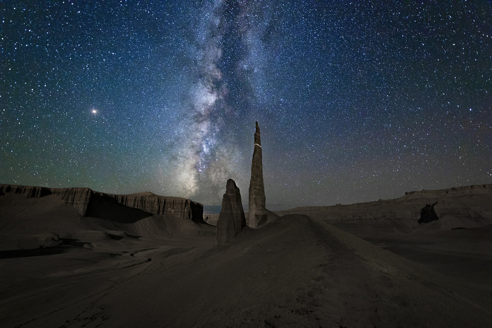
'Shuttle to Galaxy' by Michael Zheng
Milky Way and Sunlight
The photo above used the moonlight in night landscape photography.
“Patagonia Autumn Night” by Yan Zhang is an excellent example of using scattered sunlight in night-time landscape photos.
To take this picture required three important aspects: the right location – a small lake, with the Fitz Roy peaks facing the West and outlined by the sunrise; the Milky Way visible above the peaks, and the sun located just below the horizon. The latter is especially important: if the sun is too low, the Fitz Roy peaks will not be illuminated; on the other hand, if it is too high, the Milky Way will not be visible. As you can see in his plan below, the sun was -18° below the horizon at 7:30 a.m. of May 10, 2016. This perfect timing allowed him to capture the stunning Milky Way and highlight the Fitz Roy peaks.
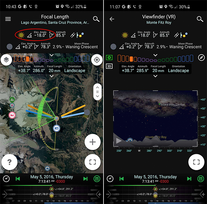
Fitz Roy Map
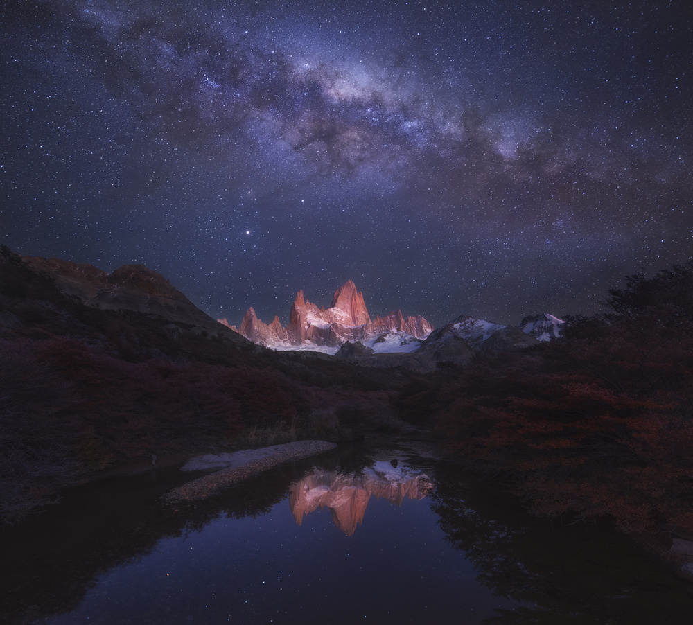
'Patagonia Autumn Night' by Yan Zhang
Milky Way and Moon
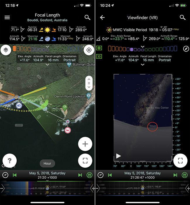
On the coast near Sydney, there is an area with several intriguing rocks. Jingshu Zhu (jasminezhu) prepared to shoot these rocks with the vertical Milky Way. Interestingly, she also decided to include the moonrise in the picture. As you can see in her plan, on May 5, 2018, moonrise was at 9:16 pm, and it was perfectly lined up with the Milky Way.
MW Moon Map

'Moon and Milky way' by Jingshu Zhu
Meteor Showers
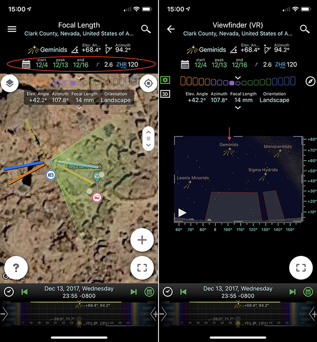
Planit lists all meteor shower information, such as their peak time, brightness, number of peak shooting stars per hour (ZHR) and moving trails. These features are incredibly useful when it comes to planning photos of meteor showers. For example, I used Planit to plan my shoot of the Geminids meteor shower on December 13, 2017. Just one day before my trip, I chose Elephant Rock in the Valley of Fire State Park, USA as my subject. As indicated in the following plan, Elephant Rock is facing the East, and the Geminids were within this composition for my entire shooting period (8:30 pm to 1:00 am).
Elephant Rock Geminids Map
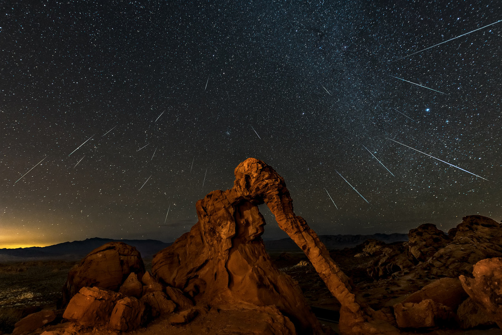
'Geminid meteor shower above the Elephant Rock' by Hua Zhu
Eclipses
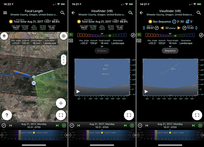
Planit has data for solar eclipses and lunar eclipses for the next three centuries. Not only can you find out the exact location in order to observe those rare events, but you can also pre-visualize the composition beforehand using one of Planit’s features. “Painted Hills with Solar Eclipse” by Wenjie Qiao (wenjieqiao) below was taken during the Great America Eclipse in 2017 at Painted Hills, Oregon, USA. He used Planit to find out that the Painted Hill was right on the centre of the eclipse zone. One day before the eclipse, he went there to scout the location and decided on this exact location where the sun is right above the highest point of the hills at its maximum eclipse. He also used the sequence feature to find out the best focal length to use in order to capture the whole eclipse sequence as well as the exposure feature to find out the correct exposure settings at various stages of the eclipse. Since the total eclipse lasts for less than 2 minutes, there is no time to try different exposures and only one chance to get it right. The picture below is a result of a well-prepared effort.
Eclipse Map
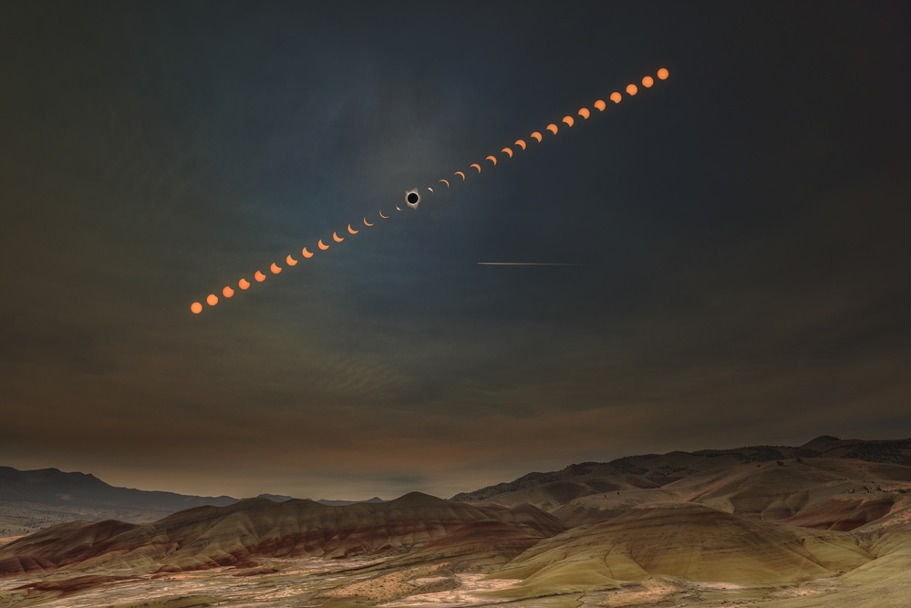
'Painted Hills with Solar Eclipse' by Wenjie Qiao
Rainbow Position
Most rainbows we see are produced by sunlight. However, they can also be produced by moonlight as well, creating a lunar rainbow or moon-bow. Moon-bows are hardly visible to the naked eye because they are much weaker than ordinary rainbows and require the moon to be nearr or at its brightest full moon phase, as well as a certain angle. With the help of Planit, you have a higher chance to catch a unique event like this. The following photo was taken at Tunnel View, Yosemite National Park, USA, on February 11, 2017. At the time, we did not know that a moon-bow would be visible from Bridalveil Fall, but Planit informed me that one would appear around 3:40-4:00 a.m. Additional requirements are clear sky and the fall has sufficient water. This kind of opportunity rarely occurs.
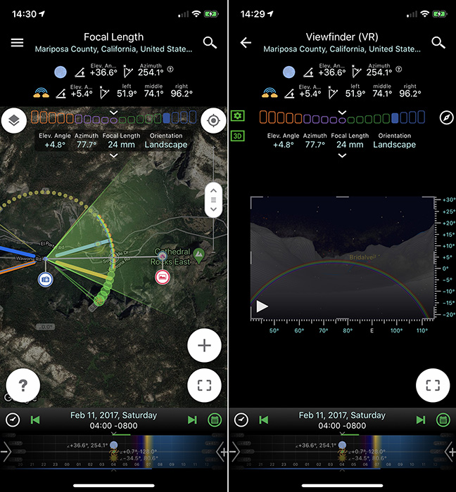
Moon-bow Tunnel View Map
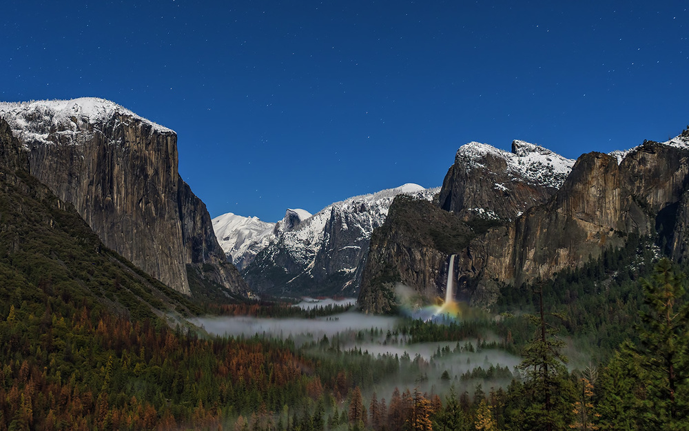
'Bridalveil Fall Moonbow' by Hua Zhu
To further validate the moon-bow prediction feature, I made another plan to shoot the moon-bow at Skogafoss Waterfall, Iceland. Based on this plan, the moon-bow should appear at late night and the big dipper is just above the fall. I arrived at the waterfall late at night on October 22, 2018 and shot photos of the moon-bow at 11:25 p.m., while most people were sleeping.
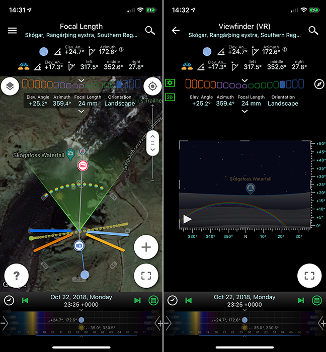
Skogafoss Map
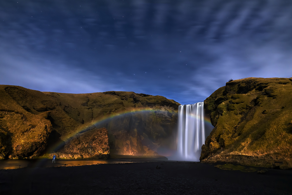
'Lunar rainbow over Skogafoss Fall' by Hua Zhu
Tide Height
When photographing coastal landscapes, photographers often need to figure out information about the tide for safety considerations and to determine optimal tide levels as related to the shooting subject. The Planit app can also be used for this situation. For example, in order to take this “Starfish Rocks” photo at sunset, the tide had to be low for two reasons: starfish can only be visible at low tide, and more importantly, the location can only be approached at low tide as it is extremely dangerous at high tide. Planit helped me select a date that met both the low tide and sunset criteria – on July 23, 2016 5:10 p.m., the sunset and low tide occurred simultaneously.
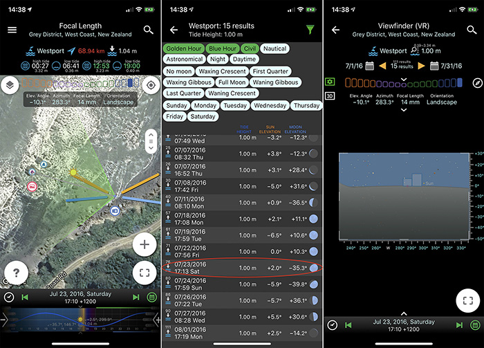
Starfish Rocks Map
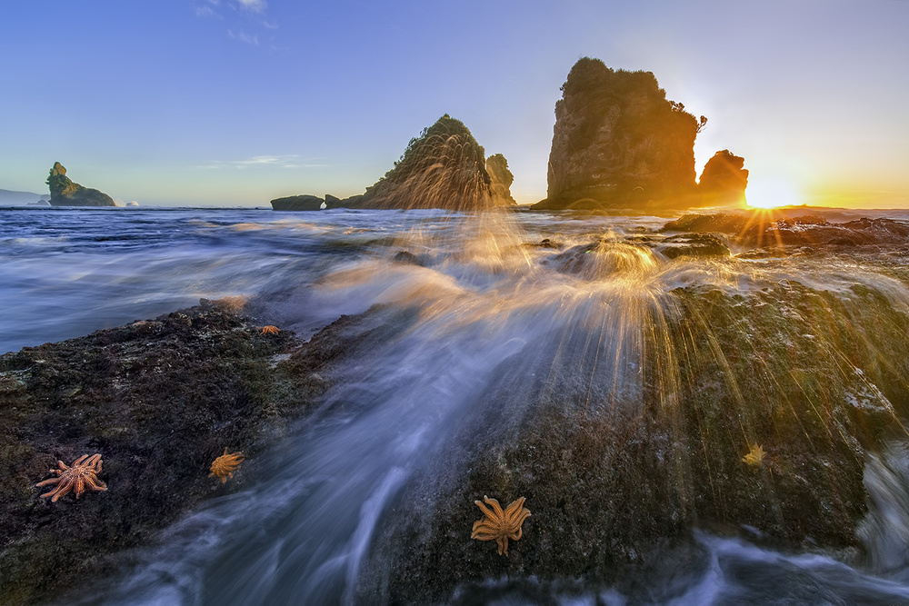
'Starfish rocks' by Hua Zhu
We live in a vast universe where there are endless mysteries waiting to be discovered. Captivating and sometimes even unexplainable events constantly occur around us, whether or not we are aware of it.
Some phenomena occur so rarely that if we miss the opportunity to capture them, we may never get to do so again in our lifetime.
The rapid development of science and technology, along with the power of computing, allows us to predict the occurrence of these moments accurately and plan our photos efficiently.
The Planit app provides us with all the required information in our hands and more, empowering us to formulate our ideas right at home, capture exquisite ephemeris moments, and combine them with the world around us to get our dream pictures.
 | Write |
 | Hua Zhu PRO Vladimir Asriyan, Thanks! |
| | Hua Zhu PRO Yvette: Thank you so much for suporting and editing this article! |
 | Saskia Dingemans PRO Prachtige foto's en een zeer interessante app ,Yvette.
Hoe kan ik hem vinden in de play store en waar kan ik hem aan herkennen want er zijn meerdere planet apps . Hoe ziet het icoontje eruit? Gr,Sas |
 | Yvette Depaepe CREW Zoeken naar PLANIT app voor fotografie, Saskia. Het ikoontje is een driekleurige cirkel met in het midden een aardbol. Wel Planit, geen planet. Uiterst interessant, inderdaad. Heb die al veel gebruikt, vooral in het buitenland maar evengoed te gebruiken in eigen streek.
Sukses !!! |
| Saskia Dingemans PRO Dankjewel ,Yvette .Ik ga er naar kijken .
|
 | Vladimir Asriyan Excellent article about a wonderful application that once again emphasizes that photography is a synthesis of science and art. I enjoyed reading your article dear Hua Zhu. Also many thanks to Yvette for her great work in popularizing photography. |
| Yvette Depaepe CREW Thanks Vlad ;-) |
| | Yvette Depaepe CREW Thank you so much for this most interesting article, Hua Zhu! The Planit app is a fantastic tool. Great Planit maps with splendid application examples. My very best compliments, dear friend. |